
|
.bmp) English
English.bmp) Español
EspañolBioP: Biological Prediction

Introduction:
All species of animals and plants occupy a more or less well-defined geographical
region, called their areas, or ranges, of distribution. It is one of the most fundamental
expressions of its ecology and evolutionary history (Udvardy, 1969; Brown, Stevens
and Kaufman, 1996; Gaston and Blackburn, 2000). A species distribution is the
product of a complex combination of processes (Gaston and Blackburn, 2000), that
begin with the apparition of the species by evolution, and its movements in ecological
and geological times. The distribution is determined by factors affecting: (1)
the regions in space where the right autoecological conditions for the survival of the
species (climate, soil, energy availability, etc.) are met, (2) the regions of space that
are available to the dispersal of the species, and (3) the presence or absence of crucial
population interactions, that is, key competitors, predators, diseases, and mutualists
(seed dispersers, pollinators, and so on). It is quite likely that at different spatial and
temporal scales this complex of factors operate with different intensity.
Detailed knowledge of distribution areas is relevant to address basic questions in
biogeography and ecology, but it is also useful in the management of biodiversity for
conservation or sustainable use. Problems like the relative roles of ecological and
historical factors in shaping them, how the shape of the area changes with the spatial
scale of observation, and the relative importance of the local (or alpha) and the
turnover (or beta) components of biodiversity, depend on being able to estimate in
detail such areas. Moreover, such detailed knowledge can be used to determine the
areas best suited for conservation, the regions where given activities can endanger
protected species, and so on.
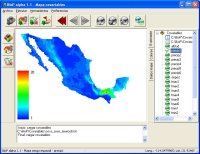
Screenshots
References
Argáez-Sosa, J. 2003. Estimación de la probabilidad de presencia de una especie con base en mediciones de covariables y diseño de zonas para proteger especies. PhD thesis, Centro de Investición en Matemáticas, Guanajuato, Mexico.
Argáez-Sosa, J., Christen, J.A., Nakamura, M. y Soberón, J. 2005. Prediction of high potential areas of habitat for monitored species. Environmental and Ecological Statistics 12, 27-44.